


RURAL GLENROCK Voting District, Converse County, Wyoming
About
Outline
Summary
| Unique Area Identifier | 698564 |
| Name | RURAL GLENROCK Voting District |
| County | Converse County |
| State | Wyoming |
| Area (square miles) | 955.11 |
| Land Area (square miles) | 953.82 |
| Water Area (square miles) | 1.29 |
| % of Land Area | 99.86 |
| % of Water Area | 0.14 |
| Latitude of the Internal Point | 43.18068840 |
| Longtitude of the Internal Point | -105.89855190 |
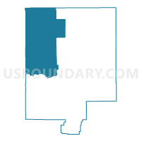
Maps


Graphs
Select a template below for downloading or customizing gragh for RURAL GLENROCK Voting District, Converse County, Wyoming


Neighbors
Neighoring Voting District (by Name) Neighboring Voting District on the Map
- 4-J SCHOOL #1 Voting District, Campbell County, WY
- BOXELDER Voting District, Converse County, WY
- DRY CREEK Voting District, Converse County, WY
- EDGERTON TOWN HALL Voting District, Natrona County, WY
- EVANSVILLE OUTSIDE Voting District, Natrona County, WY
- LA PRELE Voting District, Converse County, WY
- LINCH Voting District, Johnson County, WY
- ORPHA Voting District, Converse County, WY
- ROLLING HILLS Voting District, Converse County, WY
- WARDWELL WATER & SEWER Voting District, Natrona County, WY
- WRIGHT TOWN HALL #1 Voting District, Campbell County, WY
Top 10 Neighboring County Subdivision (by Population) Neighboring County Subdivision on the Map
- Gillette South CCD, Campbell County, WY (15,365)
- Douglas CCD, Converse County, WY (9,537)
- Casper North CCD, Natrona County, WY (5,620)
- Glenrock CCD, Converse County, WY (4,296)
- Kaycee CCD, Johnson County, WY (832)
Top 10 Neighboring Place (by Population) Neighboring Place on the Map
Top 10 Neighboring Unified School District (by Population) Neighboring Unified School District on the Map
- Natrona County School District 1, WY (75,450)
- Campbell County School District 1, WY (46,133)
- Converse County School District 1, WY (9,557)
- Johnson County School District 1, WY (8,569)
- Converse County School District 2, WY (4,276)
Top 10 Neighboring State Legislative District Lower Chamber (by Population) Neighboring State Legislative District Lower Chamber on the Map
- State House District 31, WY (14,418)
- State House District 52, WY (12,056)
- State House District 35, WY (11,445)
- State House District 58, WY (10,860)
- State House District 40, WY (9,987)
- State House District 6, WY (9,518)
Top 10 Neighboring State Legislative District Upper Chamber (by Population) Neighboring State Legislative District Upper Chamber on the Map
- State Senate District 23, WY (26,474)
- State Senate District 30, WY (20,562)
- State Senate District 27, WY (20,320)
- State Senate District 22, WY (19,515)
- State Senate District 2, WY (18,410)
Top 10 Neighboring 111th Congressional District (by Population) Neighboring 111th Congressional District on the Map
Top 10 Neighboring Census Tract (by Population) Neighboring Census Tract on the Map
- Census Tract 1, Campbell County, WY (8,924)
- Census Tract 14.01, Natrona County, WY (5,620)
- Census Tract 9566, Converse County, WY (3,194)
- Census Tract 9567, Converse County, WY (2,853)
- Census Tract 9551, Johnson County, WY (2,475)
Top 10 Neighboring 5-Digit ZIP Code Tabulation Area (by Population) Neighboring 5-Digit ZIP Code Tabulation Area on the Map
- 82601, WY (27,400)
- 82718, WY (23,003)
- 82633, WY (9,592)
- 82637, WY (4,136)
- 82636, WY (3,981)
- 82640, WY (29)